Code for AIZU releases "Aizuwakamatsu Fire Hydrant Map" application

Information
お知らせ

"Code for AIZU," an academia-industry-government organization formed during a series of "Aizu Open Innovation Meetings" (AOI Meetings) has developed a web application, "Aizuwakamatsu Fire Hydrant Map." The application shows the location of fire hydrants and other fire-fighting water sources in Aizuwakamatsu City. The application was released this winter and is now in use by local fire departments. AOI Meetings were created by the University of Aizu Revitalization Center to function as a place to openly discuss solutions for local needs.
The application, which incorporates open data provided by Aizuwakamatsu City, was developed by a local venture company to satisfy the need for local fire departments to be able to find fire hydrants during a disaster or after heavy snowfall. The application overlays the location of fire-fighting water sources such as fire hydrants and cisterns on a map of the city.
The application has three different modes. The first mode displays an overview of fire hydrants. The second mode allows you to search for and plot a route to the closest hydrant based on your current location. The third mode allows you to search for fire hydrants by address or location name. By linking with Google Maps Street View, users can determine the precise location of fire hydrants.
A method to precisely locate fire hydrants has become an issue not only in Aizu, but in other regions as well. Several municipalities are also considering introducing the application.
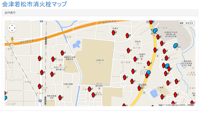
Screenshot of the application showing search results for "University of Aizu"